Stepwise Process Flow Details
-
Step 1: Assess the Walkability Factor
For this process, a network analysis of the study region is necessary. This involves the creation of a network dataset.
-
Step 2: Create a Network Dataset
The road network shapefile must be clean and free from any topology errors.
After ensuring the integrity of the shapefile, create a network dataset. o Ensure you have the "QNEAT3" plugin installed in your QGIS.
o Load your road network shapefile in QGIS. o Use the "QNEAT3 > Create Network from Layer" tool to create a network dataset.
This will initiate the creation of a network dataset using the road layer.
-
Step 3: Conduct a Proximity Study
Use the "QNEAT3 > Service Area (from Layer)" tool to conduct a proximity study using the locations of existing public toilets as input data.
-
Step 4: Create a Network Buffer
For each public toilet, create a network buffer representing a walkability distance of 500 feet.
Step 5: Overlay the Data with Commercial Land Use
Use the "Vector > Geoprocessing Tools > Intersect" tool to overlay the buffer data with the commercial land use data. This will help you identify major commercial areas and public places outside the walkability region of the public toilets.
-
Step 6: Identify New Toilet Locations
Based on the overlay analysis, pinpoint potential locations for new toilets. These should be in areas currently underserved by the existing public toilets, particularly in commercial and high traffic areas.
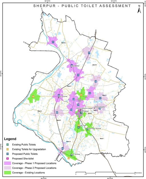

Figure 14 Illustrations of public toilet assessment of Sherpur, Bangladesh
Source – CWIS spatial analysis, Innpact Solutions and GWSC
No Comments