4.2 Sewer Data Collection
Once the map is visible, click the "Locate Myself" button to find your exact location. If your location point (blue marker) is not accurate on the map, make sure it is correctly placed by referencing nearby roads and buildings displayed by Google Maps and the WMS layer. If your location is accurately displayed on the map, you can inspect the area around the building’s perimeter, follow the blue marker indicating your current location, look for any pipes or markers that indicate underground utilities, and enter the data of the building's sewer connection accordingly.
The user can also turn the WMS layer on to view the pre-existing buildings.
When the user taps the save icon, a dialogue box will appear, and the user will need to select the Building Identification Number (BIN) and Sewer Code of the building from the displayed dropdown options, and then tap 'Save'.
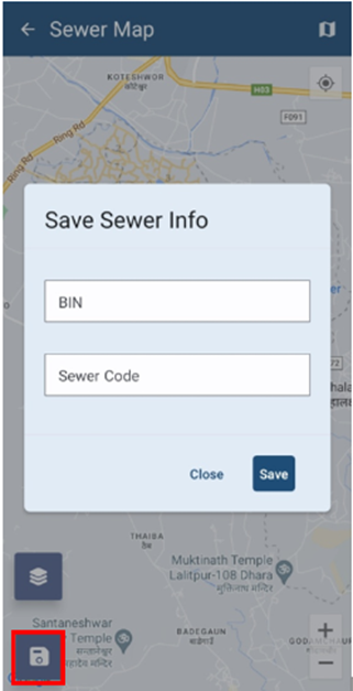
Figure 4-5 Save Button on Map
No Comments