|
|
|
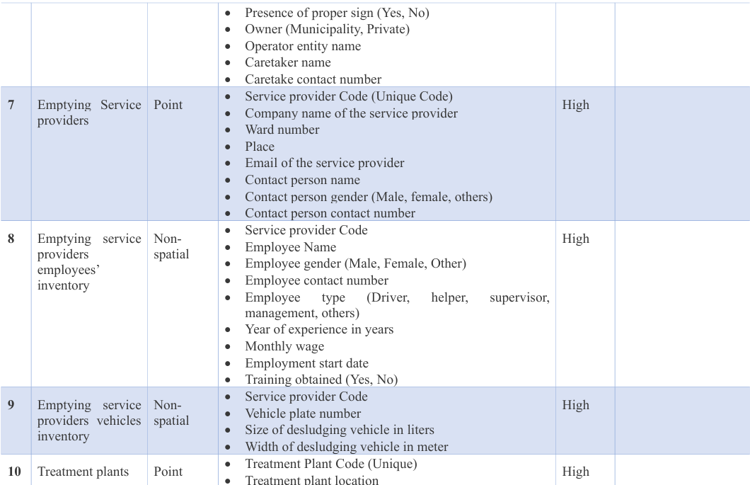
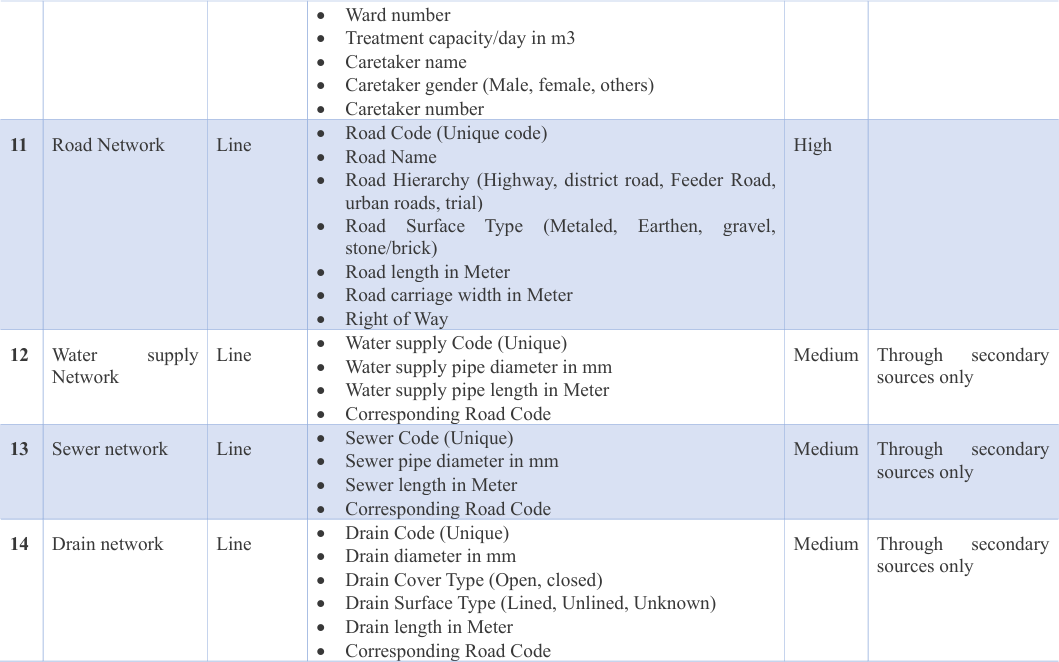
Treatment capacity/day in m3
|
|
|
|
|
|
|
|
|
|
|
|
|
|
|
|
Caretaker gender (Male, female, others)
|
|
|
|
|
|
|
|
|
|
|
|
|
11 |
Road Network |
Line |
Road Code (Unique code)
Road Name
Road Hierarchy (Highway, district road, Feeder urban roads, trial)
Road Surface Type (Metaled, stone/brick)
Road length in Meter
Road carriage width in Meter
Right of Way
|
Earthen, |
Road, gravel, |
High |
|
12 |
Water supply Network |
Line |
Water supply Code (Unique)
Water supply pipe diameter in mm
Water supply pipe length in Meter
Corresponding Road Code
|
|
|
Medium |
Through secondary sources only |
13 |
Sewer network |
Line |
Sewer Code (Unique)
Sewer pipe diameter in mm
Sewer length in Meter
Corresponding Road Code
|
|
|
Medium |
Through secondary sources only |
14 |
Drain network |
Line |
Drain Code (Unique)
Drain diameter in mm
Drain Cover Type (Open, closed)
Drain Surface Type (Lined, Unlined, Unknown)
Drain length in Meter
Corresponding Road Code
|
Medium |
Through secondary sources only |
|
|
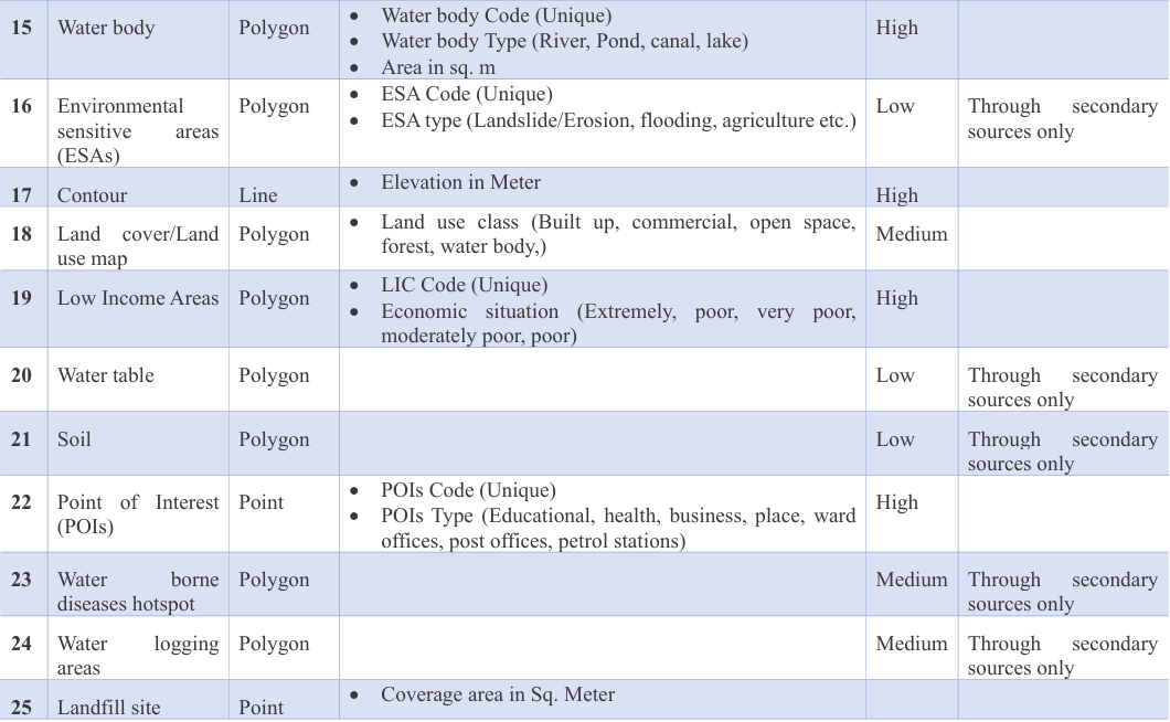
15 |
Water body |
Polygon |
Water body Code (Unique)
Water body Type (River, Pond, canal, lake)
Area in sq. m
|
High |
|
|
|
16 |
Environmental sensitive areas (ESAs) |
Polygon |
ESA Code (Unique)
ESA type (Landslide/Erosion, flooding, agriculture etc.)
|
Low |
Through secondary sources only |
|
|
17 |
Contour |
Line |
|
High |
|
|
|
18 |
Land cover/Land use map |
Polygon |
Land use class (Built up, commercial, open space, forest, water body,)
|
Medium |
|
|
|
19 |
Low Income Areas |
Polygon |
LIC Code (Unique)
Economic situation (Extremely, poor, very poor, moderately poor, poor)
|
High |
|
|
|
20 |
Water table |
Polygon |
|
Low |
Through secondary sources only |
|
|
21 |
Soil |
Polygon |
|
Low |
Through secondary sources only |
|
|
22 |
Point of Interest (POIs) |
Point |
POIs Code (Unique)
POIs Type (Educational, health, business, place, ward offices, post offices, petrol stations)
|
High |
|
|
|
23 |
Water borne diseases hotspot |
Polygon |
|
Medium |
Through secondary sources only |
|
|
24 |
Water logging areas |
Polygon |
|
Medium |
Through secondary sources only |
|
|
25 |
Landfill site |
Point |
Coverage area in Sq. Meter
|
|
|
|
|